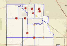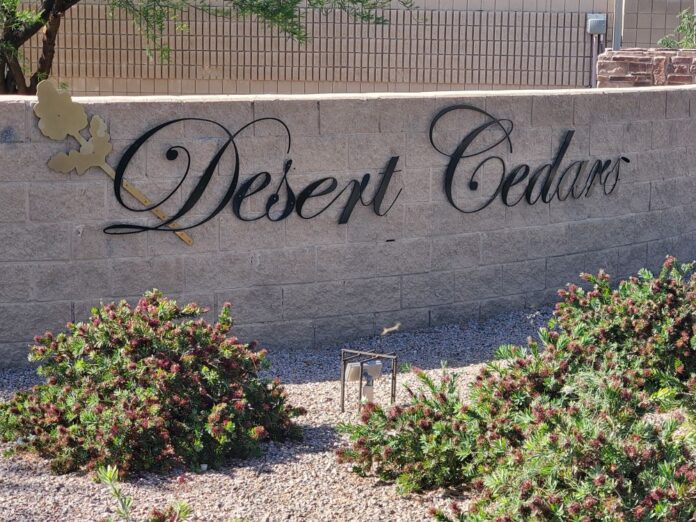
Some Maricopa residents are required to purchase flood insurance even though they live miles from the nearest wash. But their expensive plight moved closer to ending at the May 6 Maricopa Flood Control District meeting.
The district approved a plan allowing the City of Maricopa – if it approves the project – to raise the land at the corner of Bowlin Road and State Route 347 about 18 inches with compacted fill dirt.
That parcel is prone to flooding, which has been a hindrance to development of the area.
The second part of the remediation plan is to improve trenching along the access road to the east of Copper Sky. By doing so, MFCD district manager David Alley said water in that area will be diverted to existing retention basins.
“In that area, it may end up being that the access road just needs to be graded differently so water can make it into the retention basins on west side of access road,” Alley said. “Water is making its way north of Copper Sky and into Desert Cedars.”
He said there are small retention basins along the access road and the athletic fields are also an overflow retention area, and if the City can correct that issue, the retention basins will be far more effective in providing the necessary relief.
Alley said this action should allow the City to receive a Conditional Letter of Map Revision (CLOMR), which would change the floodplain map and remove Desert Cedars homes from the floodplain, thus removing the requirement for the residents to purchase flood insurance.
“This gives us the CLOMR that we are looking for, which is a big step up from where we started,” Alley said. “What we were trying to do was just to figure out if we could solve this problem. What we found out pretty quickly was that the problem could be solved and that it wouldn’t have to be a real expensive fix. We were able to do that without using all the grant money (the City received from the Federal Emergency Management Agency) in 2018.”
The engineering study was completed last year and came in $20,000 under budget, according to Alley. The district then went back to FEMA to request using leftover grant money to obtain the CLOMR, and FEMA agreed. The final cost to the City, should it not need to tap a $5,000 contingency fund in the bid from engineering firm Wood Patel, would be about $23,000.
“This is good news that FEMA said yes, it’s OK to use the grant money this way,” Alley said before the vote. “I think it’s going to be a big gain for the people of Desert Cedars and the city of Maricopa. Since we (MFCD) have got the money in the budget, I would recommend we do this.”
The board approved the recommendation by a 3-0 vote.
All the land requiring work to finish the project is owned by the City, making the project faster and easier as no land acquisition or easements are required.
The ramifications for Desert Cedars homeowners are significant. After several major storms hit the United States in recent years, flood insurance rates increased dramatically. according to Alley.
“Flood insurance wasn’t a really big deal before (hurricanes) Sandy and Katrina, and some other storms hit over the course of four or five years or so, and FEMA’s insurance really got hammered,” Alley said. “Then they realized they had to do something, and the flood premiums went from hundreds of dollars a year to thousands a year.”
“Normally, for a project like that the construction part should only take a couple of months,” Alley said. “We’re just talking about bringing in fill and compacting the soil so it’s pretty simple. If everything goes according to plan with the CLOMR approval we could have the new map by the end of this year. So, we could have this done by spring or summer of next year, depending on how motivated the City is to develop that piece of land.”




![Maricopa’s ‘TikTok Rizz Party,’ explained One of several flyers for a "TikTok rizz party" is taped to a door in the Maricopa Business Center along Honeycutt Road on April 23, 2024. [Monica D. Spencer]](https://www.inmaricopa.com/wp-content/uploads/2024/04/spencer-042324-tiktok-rizz-party-flyer-web-218x150.jpg)



![Alleged car thief released without charges Phoenix police stop a stolen vehicle on April 20, 2024. [Facebook]](https://www.inmaricopa.com/wp-content/uploads/2024/04/IMG_5040-218x150.jpg)
