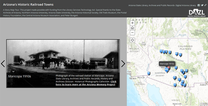
The Digital Arizona Library (DAZL) has launched its first Arizona Maps Online project, Arizona’s Historic Railroad Towns, which includes Maricopa.
https://azlibrary.maps.arcgis.com/apps/MapTour/index.html?appid=4b903db0abbd49ab9eb7a18cf04ff05b
The fully interactive map allows users to explore archival maps and historical photos of railroad stations throughout the Grand Canyon State. The maps date back to 1905-1918, and include stations from dozens of locations, including Phoenix, Tucson, Flagstaff, Bisbee, Globe, Nogales, and Yuma. People can also project the maps over modern satellite imagery to view what the stations looked like then and what the same location looks like today.
“DAZL continues to work hard on new educational projects, and they will have more great maps in the future,” said Secretary of State Michele Reagan. “Our Digital Library is a great resource for students, researchers and history buffs of all ages. From Digital Newspapers and the Arizona Memory Project, DAZL makes it easy to learn about Arizona’s history without having to leave home.”
DAZL is a branch of the State Library, Archives and Public Records division of the Arizona Secretary of State’s office.


![Alleged car thief released without charges Phoenix police stop a stolen vehicle on April 20, 2024. [Facebook]](https://www.inmaricopa.com/wp-content/uploads/2024/04/IMG_5040-218x150.jpg)
![Locals find zen with Earth Day drum circle Lizz Fiedorczyk instructs a drum circle at Maricopa Community Center April 22, 2024. [Brian Petersheim Jr.]](https://www.inmaricopa.com/wp-content/uploads/2024/04/PJ_3922-Enhanced-NR-218x150.jpg)


![Alleged car thief released without charges Phoenix police stop a stolen vehicle on April 20, 2024. [Facebook]](https://www.inmaricopa.com/wp-content/uploads/2024/04/IMG_5040-100x70.jpg)
![Locals find zen with Earth Day drum circle Lizz Fiedorczyk instructs a drum circle at Maricopa Community Center April 22, 2024. [Brian Petersheim Jr.]](https://www.inmaricopa.com/wp-content/uploads/2024/04/PJ_3922-Enhanced-NR-100x70.jpg)
