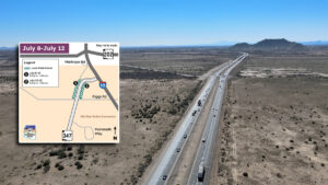


Starting today, crews are working at the intersection of Smith-Enke and Porter Roads to install pedestrian crosswalk signals to improve pedestrian safety.
Temporary lane closures are scheduled Sept. 12, 13 and 17 between 9 a.m. and 2 p.m. near the intersection that separates four major Maricopa neighborhoods, Rancho El Dorado, The Lakes, Province and Homestead.
“This project is part of the city’s ongoing commitment to assessing and addressing the traffic and safety needs as our city grows,” city government spokesperson Monica Williams said this morning.
Keeping up with the growth
The intersection was chosen due to a significant increase in pedestrian and vehicle traffic, which was noted by Maricopa’s traffic engineer.
“The city of Maricopa follows the Manual on Uniform Traffic Control Devices, or MUTCD, a code that is adopted by the state of Arizona,” said Scott Nodes, the traffic engineer. “That code sets a standard for the criteria we have to consider when placing a traffic signal or stop sign.”
Nodes said there are three main elements that are looked at. They include the type of street, observation data, crash and traffic flow data, as well as landmarks in the surrounding area that impact the usage of an intersection.
If the proper criteria are met, then it can be added to Maricopa’s Capital Improvement Project Plan, as was the case with the crosswalk that saw new improvements break ground today.
Type of street
There are three main types of roadways in Maricopa: residential, collector and arterial. Residential is a roadway traditionally lined with homes. A collector street does just that, collects and brings other roadways together and moves traffic to the arterial or high-capacity roadways.
Examples of a collector street include Rancho Mirage Boulevard or Butterfield Parkway, and examples of an arterial road include Smith-Enke Road, Honeycutt Road and John Wayne Parkway.
“Categorizing the type of roadway is important because it determines what other criteria must be met in order to place a stop sign or traffic signal,” Nodes explained.
A data-driven decision
Nodes said in order to see if the established criteria are met, he begins collecting data. This includes working with the police department to collect data on crashes that could be avoided with the addition of a new traffic control pattern, as well as traffic flow and average everyday usage data.
“I also go a step further and drive every single leg of an intersection.” Nodes said. “I want to know if there are any blind spots drivers face when trying to move through the intersection or are there long periods of waiting in one direction versus another.”
Understanding the surrounding area
With the usage data in hand, Nodes also said he has to take into account the surrounding area. For example, at the intersection of Butterfield Parkway and Edison Road, there is not only a residential community that people walk around, but also a large shopping center nearby as well as an elementary school. This can lead to peak traffic hours and additional pedestrians, all impacting the decision for the recent intersection upgrade.
How are new intersections selected?
Intersections needing a new traffic signal or stop signs are identified in two ways: proactively by the city as traffic and development in an area grows or through submissions by community members.
“By working closely with residents and continuously monitoring traffic patterns, we ensure that our intersections remain safe and efficient for everyone. Community input is invaluable in this process, and we encourage citizens to report concerns or suggestions,” said Keith Brown, Maricopa’s public works director.
If residents want to draw the city’s attention to a particular area, they can submit a report for intersections, potholes or other roadway concerns here.