

Storms producing heavy rain and gusty winds developed north and east of Phoenix on Friday, but chances are slim they will push west enough to bring the first measurable rain to Phoenix Sky Harbor International Airport in 104 days.

That dry stretch is only 21st on the list of longest measurable rainless streaks, according to the National Weather Service in Phoenix. The longest rainless stretch – 160 days – ended June 6, 1972. If we go another two weeks and reach 118 days, the stretch will leap onto the Top 10 rainless streaks at No. 9. (If you’re wondering, a measurable amount of rain is defined as one hundredth of an inch or more, which typically produces enough runoff to form puddles.)
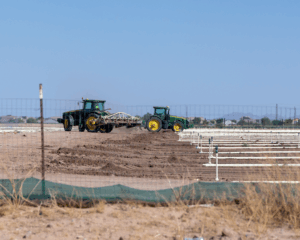
On the plus side, cloudy skies on Thursday meant a high temperature of only 97 in Maricopa, with the temperature falling to 82 overnight Friday. Abundant sunshine on Friday, however, meant a return to higher temps – about 105 degrees.
There is a decreasing chance of showers and thunderstorms through the weekend. If we haven’t had any rain by Saturday afternoon, we probably won’t. A high temperature of 101 degrees is forecast on Saturday and 105 degrees on Sunday, the weather service says. Both days will be sunny.
Here is the 7-day forecast from the weather service:
Friday night: A chance of showers and thunderstorms. Mostly cloudy, with a low around 80. West southwest wind 5 to 10 mph becoming east after midnight. Chance of precipitation is 30%.
Saturday: A 20 percent chance of showers before 11 a.m. Sunny, with a high near 101. North northeast wind around 5 mph becoming calm in the morning.
Saturday night: Partly cloudy, with a low around 82. North wind around 5 mph becoming calm in the evening.
Sunday: Sunny, with a high near 105. South southeast wind around 5 mph becoming calm.
Sunday night: Mostly clear, with a low around 83. Calm wind becoming southwest around 5 mph.
Monday: Sunny, with a high near 108. South southeast wind around 5 mph becoming calm in the afternoon.
Monday night: Mostly clear, with a low around 84. Calm wind becoming east around 5 mph after midnight.
Tuesday: Sunny, with a high near 108. East southeast wind around 5 mph becoming calm in the afternoon.
Tuesday night: Mostly clear, with a low around 85. Calm wind becoming west southwest around 5 mph after midnight.
Wednesday: Sunny, with a high near 109. West southwest wind around 5 mph.
Wednesday night: Mostly clear, with a low around 86. West wind around 5 mph.
Thursday: Sunny and hot, with a high near 110. West northwest wind around 5 mph.
Thursday night: Mostly clear, with a low around 87. West southwest wind around 5 mph.
Friday: Sunny, with a high near 109. West wind around 5 mph.