

People are moving to Maricopa every day. But do the newcomers — or the old timers, for that matter — give any thought to the names on our street signs, with the possible exception of John Wayne, of course.
InMaricopa delved into local history to tell you how some of our local roads received their names.
PORTER ROAD
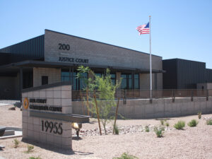
Elton K. Porter farmed in Maricopa in the early 1950s. He and other community volunteers dug a large ditch at Porter Road and Maricopa-Casa Grande Highway and filled it with water, creating a popular swimming hole for teens in the early 1950s. In 1954, he died of a heart attack while fighting the fire that destroyed Maricopa Elementary School, the town’s 1914 red-brick school. The name of the school was changed to Elton K. Porter Elementary School for the former school board member, but over time returned to its original name.
Porter Road is a north-south road that runs from the Gila River Indian Reservation in the north and dead-ends at Peters and Nall Road on the Ak-Chin Reservation in the south.
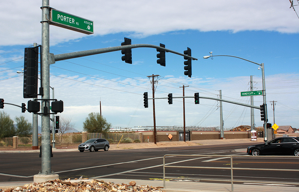
HONEYCUTT ROAD | HONEYCUTT AVENUE
Honeycutt Road and Honeycutt Avenue were named for a local farmer, Chasen Powell (C.P.) Honeycutt, who in 1952 bought the McDavid farm south of the tracks. In 1953, the Honeycutts purchased the former Calhoun farm north of the tracks and built the Honeycutt Shopping Center in 1954. At one time, Honeycutt farmed as many as 3,600 acres. He built his first home on the farm from barracks acquired from the World War II Japanese detention camp near Sacaton — a home that sat just south of Honeycutt Avenue on the west side of the old Maricopa Road for the next 35 years.
As a businessman, Honeycutt was involved in many community projects. His greatest love and passion, however, was horses, which consumed most of his spare time after he turned 40. Honeycutt Stables became a famous hangout for cutting horse enthusiasts around the world.
Honeycutt Road is north of the railroad tracks and runs eastward about 6.5 miles from the State Route 347 overpass to Murphy Road. Just south of the overpass, Honeycutt Avenue runs from John Wayne Parkway to Hogenes Boulevard.
SMITH-ENKE ROAD
Smith-Enke Road, one of the most prominent streets in Maricopa, was named for local farmers John Smith and Fred Enke. They were teammates on the University of Arizona football team in the 1940s, with quarterback Enke throwing to receiver Smith. Enke played professionally in the National Football League.
Smith took a job as a foreman on a cotton farm west of Maricopa after graduating from U of A with a business degree in 1950. In 1953, Enke and he became partners in an area farm. They built Smith-Enke Road as a way to get to their cotton farm. When the business expanded later, they split ways in 1963.
Smith and his wife Mary Lou became permanent residents of Maricopa in 1956, building a home in the middle of farmland in what is now The Villages at Rancho El Dorado. The Smiths have served the community for more than 40 years, donating land for a swimming pool, working as volunteers for the library and serving on the school board.
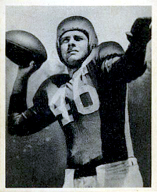
Enke was a heralded athlete at Tucson High School, where he led teams to seven state championships in three sports and became the first consensus All-American football player at Arizona. He went on to play seven years in the NFL as quarterback for the Detroit Lions, Philadelphia Eagles and Baltimore Colts. Late in his NFL career, Enke would help Smith tend to the cotton fields, then go off to play in the fall. He sold his farm in 1983 to the U of A, where the Maricopa Agricultural Center is now located. He grew grapes in Hidden Valley until about 2000. He died in April 2014.
Smith-Enke is an east-west road, running from Murphy Road in the east to the western side of State Route 347, where it becomes State Route 238.
HARTMAN ROAD
Hartman Road is named for Dr. Phillip Hartman, who bought his namesake farm in the late 1940s. His son, Phillip McDavid, took over the operation in 1960 and continues to farm it today. The road runs from the Gila River Indian Reservation to Peters and Nall Road in the south, and runs through the Santa Cruz Wash.
EDWARDS AVENUE
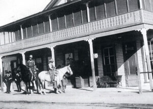
Edwards Avenue recalls the pioneer couple James and Mary Ellen Edwards, who came to Maricopa in 1890. They built and operated the Edwards Hotel and a nearby trading post located directly north of the tracks for 28 years.
The short east-west road is about one-third mile in length, beginning about 500 feet south of the railroad tracks on Maricopa Road and continuing to Taft Avenue.
GARVEY ROAD
Garvey Road is thought to be named after Dan Edward Garvey, the governor of Arizona from 1948 to 1951. He was the first Arizona secretary of state to ascend to the governorship when Gov. Sidney P. Osborn died in office in May 1948. During his tenure, Garvey approved the Central Arizona Project, established the Children’s Colony, revised the state highway code and signed the Upper Colorado River Basin Compact.
Garvey Road is about a mile in length and is immediately south of Maricopa Manor Business Center on Maricopa Road. It joins State Route 238 about a mile to the west.
FARRELL ROAD
Farrell Road was named for Edward Farrell, who put down stakes on a piece of Maricopa farming land in January 1948, bought or built several Maricopa businesses and was active in a variety of community projects. He was an avid poker player and many of the late-night games he participated in took place at his Headquarters Bar.
The road runs east-west and crosses Maricopa Road about two miles south of town. It runs eastward to Porter Road and westward from Maricopa Road through the Ak-Chin Village, ending at the Palo Verde Mountains.
RALSTON ROAD
Ralston Road was named for another successful farmer. Jack Ralston moved his family to Maricopa in 1950 at a time Hidden Valley land could still be homesteaded, and the roads were unmarked in some places and otherwise full of brush. Ralston and his family often had to drive through the desert, eventually making their own roads to get into town.
The road bearing his name parallels State Route 347 about 4 miles to the west, traveling north-south from just north of State Route 238 to State Route 84.
DALLAS SMITH LANE
Dallas Smith Lane was named for the telegrapher for the Southern Pacific Railroad and M & P Railroad for many years in the early 1900s. Smith and his wife, Susie, helped organize and build the first Maricopa school in 1914. She was a great historian for the area, preserving much of Maricopa’s history and photos for future generations.
The street, south of Honeycutt Avenue, runs north-south and ends as it makes a 90-degree turn to the west.
FRED COLE LANE
Fred Cole and his family came to Maricopa in 1954. He became a much-loved postmaster and dedicated community leader and volunteer, and his family has served the Maricopa Salvation Army since the early 1940s.
The road is in the Estrella Park subdivision in the Heritage District, just south of Maricopa High School at the end of Dallas Smith Lane.
MARICOPA ROAD
Maricopa Road derived its name from the town of Maricopa, which was named for the Maricopa Native Americans, a group of five Native American reservations located in Maricopa County. The two largest are Gila River Indian Community, Maricopa’s northern neighbor, and Salt River Pima-Maricopa Indian Community, east of Scottsdale.
Maricopa Road became State Route 347 from I-10 in the north to State Route 84, though it is known as John Wayne Parkway in the city of Maricopa.
JOHN WAYNE PARKWAY
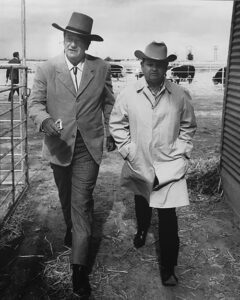
Just about everyone knows the main thoroughfare through the city is named for the actor who starred in Western films. But the popular icon had a strong connection to the area. Wayne’s film career spanned 50 years and included more than 80 films. His local impact centered around his purchase of 4,000 acres of land between Maricopa and Stanfield in the late 1950s. He formed a partnership with local farmer Louis Johnson and eventually purchased more land near Maricopa and built a feedlot that could accommodate up to 85,000 head of cattle, making it the largest privately held feedlot in the country at the time.
Note: Information for this story was provided by the Maricopa Historical Society and “Reflections of a Desert Town” by Patricia Brock.
This story appears in the March issue of InMaricopa magazine.